I have been working on some content explaining the educational potential of image collection and curation. A good part of the education value is likely in collecting the images (being there) and various post collection processes that use the images – organization, annotation,
Geotagging potentially represents a combination of being there and then using the location to associate other information with what is visible in the image. Potential is the key word here – there is no automatic benefit to pinning a photo on a map.
We have geotagged photos in a number of ways:
- estimation based on memory or using another source that verifies the location
- use of a GPS – we have a Garmin that allows us to take screen shots so we have carried tis device and our camera for some projects
- GPS enabled camera
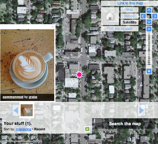
What prompted this new post is the discovery that Cindy’s iPhone 4S geotags images.When we were doing this before, we were using specialized cameras. It is my understanding that most phones use a type of cell tower triangulation rather than satellite referencing to figure out where they are (Google latitude will try satellites, cell towers or known wifi spots to determine where you are ). So, the 4S will organize images within the phone according to the location of the images and transfer this location information (EXIF) as part of the file when moved to iPhoto or Flickr (note Flickr allows you to not store the location information if you consider this a privacy issue).Here is a test shot mapped in Flickr. We did this post hoc using an image we know we collected in a specific Minneapolis coffee shop. The tag was close (wrong side of the intersection). I can’t see we have conducted the same test in open spaces (plenty of those in North Dakota), but comparing GPS and phone geotag data would be interesting. Come to think of it, comparing GPS and phone location capabilities under different conditions would make a great student project.
I wondered about my Android phone. It has location capabilities. It turns out that one can take geotagged images using Camera 360.
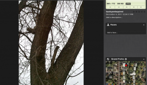
This image was taken in my backyard and uploaded to iPhoto. Check out the location in in Google and it shows the image was taken in my backyard.
So, geotags can be added with several different smart phones.
![]()

