I bought Cindy a new camera for her birthday, mother’s day, or some recent holiday. We have several very nice SLRs, but the camera I purchased had the unique capability of geotagging pictures as they were taken. In other words, the camera has a built-in GPS and coordinates are stored as part of the image file.
Cindy is preparing for some interesting adventures (e.g., a trip to Russia in September) and we anticipated that the geotagging capability would have some very interesting educational applications. We returned a week or so ago from the NECC convention in Washinton, DC and the trip gave us the opportunity to evaluate what we might be able to do with this camera.
I had intended to do this demo in Picasa, but it turns out the geotag feature does not presently function in the version available for the Mac. So, I return to my Mac fanboy roots and resorted to iPhoto. I try to be even handed but what works is what works.
So, here is what one can do with a collection of tagged images in iPhoto.

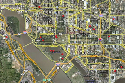
Here is the map of the collection. You can click on a pin to see photos taken at each location.

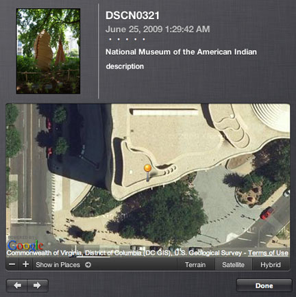
Here is a photo taken outside the American Indian museum. You see both a small insert of the image and then the location as available from Google Maps.

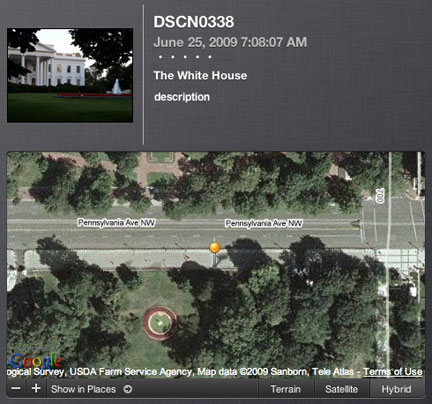
Here is a photo of the White House.

Here is the the photo and the location identified by the geotag. At first the map information confused me – no white house. Then it I realized, we are standing on Pennsylvania Ave. on the other side of the fence shooting through the trees to frame the picture.
All images that appear here have been greatly reduced in size to fit within the form factor required for this blog.
![]()
One thought on “Geotagged Pictures – Amazing”