I have long been intrigued by location based data. Location provides a context that allows one to better understand data. Often, we know something more when we identify a location and this extra information allows better understanding of an event that happened at that location.
Here is an example that may help explain this abstraction. A specific attribute of the camera on most cell phones is the geolocation capability. Exactly where was that picture taken? The capability is now usually there, but the default seems to be to have this capability turned off. I suppose this is because there is some concern regarding privacy. We are willing to share photos, but seem concerned that we would also share the location where the photo was taken (e.g., this was taken in my home and this is where my home is located). I think the location data can have many useful educational applications so learning to turn the recording and sharing of the location data associated with images on and off could be an important skill to have.
Anyway, I noticed a blog post that explained how to map a collection (set) of images stored in Flickr to Google Earth. We recently returned from a three-week adventure in Russia and we took a large number of pictures while we were there. One of the problems I always have with such picture collections is that I lose the context over time if I do not do something with the pictures immediately. I like to explain this problem based on the experience that “a month later, one mountain looks a lot like another”. With the Russia adventure, this problem might be explained as “after a month, one statue or palace looks like another”. I tend to take pictures on trips with a reasonably high quality camera, but I have also learned to take some of the same pictures with my phone (turn off your data plan). The geotags captured by the cell phone when cell phone images are mixed with the digital camera images by date and time allows some context (location) to jog my memory for events. The technique for mapping to Google Earth just provides an interesting way to display your pictures AND to view pictures taken by others at the same location.
The blog post provided by Adam Franco explains the method which amounts to loading the images of interest into a Flickr set and then executing a script that generates a KML file on the address for this set. The KML file is than loaded into Google Earth to display the location of specific pictures.
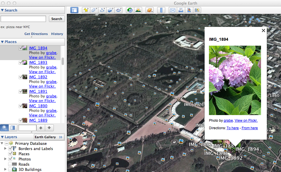
You can kind of see how this works in the image above. The KML file links to the pictures in Flickr and shows the location on the map. Other images are represented on the map and these also can be viewed.
If you would like to explore our iPhone collection (actually I did not have the settings on my new Samsung S4 set to record geotag data, but Cindy did have the setting turned on), I have placed the KML file in the public folder of my DropBox Account. Download this file and open with Google Earth.
By accident, I included a photo taken in Wisconsin with the images taken in Russia. Watching Google Earth move to accommodate the different locations is interesting. The detail in the maps is also interesting and the accuracy of the image location is impressive. Creating collections that are geotagged offers some interesting possibilities.
![]()
You must be logged in to post a comment.