Location, location, location

I have long been intrigued by location based data. Location provides a context that allows one to better understand data. Often, we know something more when we identify a location and this extra information allows better understanding of an event that happened at that location.

Here is an example that may help explain this abstraction. A specific attribute of the camera on most cell phones is the geolocation capability. Exactly where was that picture taken? The capability is now usually there, but the default seems to be to have this capability turned off. I suppose this is because there is some concern regarding privacy. We are willing to share photos, but seem concerned that we would also share the location where the photo was taken (e.g., this was taken in my home and this is where my home is located). I think the location data can have many useful educational applications so learning to turn the recording and sharing of the location data associated with images on and off could be an important skill to have.

Anyway, I noticed a blog post that explained how to map a collection (set) of images stored in Flickr to Google Earth. We recently returned from a three-week adventure in Russia and we took a large number of pictures while we were there. One of the problems I always have with such picture collections is that I lose the context over time if I do not do something with the pictures immediately. I like to explain this problem based on the experience that “a month later, one mountain looks a lot like another”. With the Russia adventure, this problem might be explained as “after a month, one statue or palace looks like another”. I tend to take pictures on trips with a reasonably high quality camera, but I have also learned to take some of the same pictures with my phone (turn off your data plan). The geotags captured by the cell phone when cell phone images are mixed with the digital camera images by date and time allows some context (location) to jog my memory for events. The technique for mapping to Google Earth just provides an interesting way to display your pictures AND to view pictures taken by others at the same location.

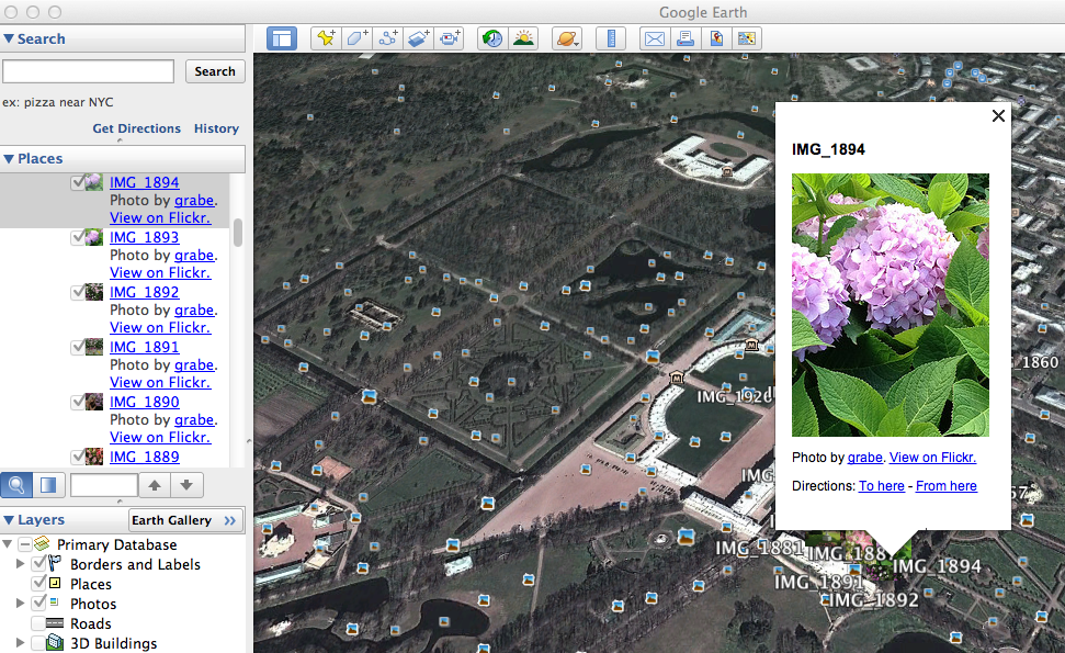
The blog post provided by Adam Franco explains the method which amounts to loading the images of interest into a Flickr set and then executing a script that generates a KML file on the address for this set. The KML file is than loaded into Google Earth to display the location of specific pictures.

russiaimagemap


You can kind of see how this works in the image above. The KML file links to the pictures in Flickr and shows the location on the map. Other images are represented on the map and these also can be viewed.

If you would like to explore our iPhone collection (actually I did not have the settings on my new Samsung S4 set to record geotag data, but Cindy did have the setting turned on), I have placed the KML file in the public folder of my DropBox Account. Download this file and open with Google Earth.

By accident, I included a photo taken in Wisconsin with the images taken in Russia. Watching Google Earth move to accommodate the different locations is interesting. The detail in the maps is also interesting and the accuracy of the image location is impressive. Creating collections that are geotagged offers some interesting possibilities.

Loading

Geotag images with your phone

I have been working on some content explaining the educational potential of image collection and curation. A good part of the education value is likely in collecting the images (being there) and various post collection processes that use the images – organization, annotation,

Geotagging potentially represents a combination of being there and then using the location to associate other information with what is visible in the image. Potential is the key word here – there is no automatic benefit to pinning a photo on a map.

We have geotagged photos in a number of ways:

  • estimation based on memory or using another source that verifies the location
  • use of a GPS – we have a Garmin that allows us to take screen shots so we have carried tis device and our camera for some projects
  • GPS enabled camera

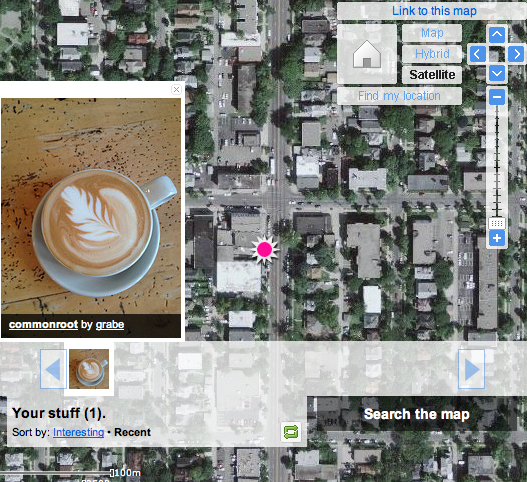
What prompted this new post is the discovery that Cindy’s iPhone 4S geotags images.When we were doing this before, we were using specialized cameras. It is my understanding that most phones use a type of cell tower triangulation rather than satellite referencing to figure out where they are  (Google latitude will try satellites, cell towers or known wifi spots to determine where you are ). So, the 4S will organize images within the phone according to the location of the images and transfer this location information (EXIF) as part of the file when moved to iPhoto or Flickr (note Flickr allows you to not store the location information if you consider this a privacy issue).Here is a test shot mapped in Flickr. We did this post hoc using an image we know we collected in a specific Minneapolis coffee shop. The tag was close (wrong side of the intersection). I can’t see we have conducted the same test in open spaces (plenty of those in North Dakota), but comparing GPS and phone geotag data would be interesting. Come to think of it, comparing GPS and phone location capabilities under different conditions would make a great student project.


I wondered about my Android phone. It has location capabilities. It turns out that one can take geotagged images using Camera 360.

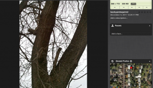
This image was taken in my backyard and uploaded to iPhoto. Check out the location in in Google and it shows the image was taken in my backyard.

So, geotags can be added with several different smart phones.

Loading

Geotagged Pictures – Amazing

I bought Cindy a new camera for her birthday, mother’s day, or some recent holiday. We have several very nice SLRs, but the camera I purchased had the unique capability of geotagging pictures as they were taken. In other words, the camera has a built-in GPS and coordinates are stored as part of the image file.

Cindy is preparing for some interesting adventures (e.g., a trip to Russia in September) and we anticipated that the geotagging capability would have some very interesting educational applications. We returned a week or so ago from the NECC convention in Washinton, DC and the trip gave us the opportunity to evaluate what we might be able to do with this camera.

I had intended to do this demo in Picasa, but it turns out the geotag feature does not presently function in the version available for the Mac. So, I return to my Mac fanboy roots and resorted to iPhoto. I try to be even handed but what works is what works.

So, here is what one can do with a collection of tagged images in iPhoto.

dcmap

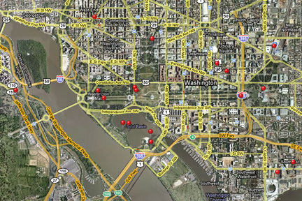
Here is the map of the collection. You can click on a pin to see photos taken at each location.

americanindianmuseum

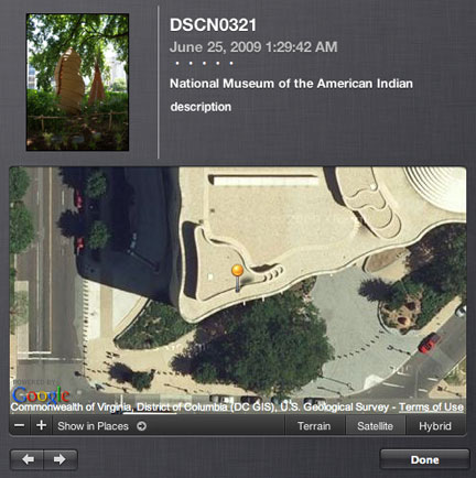
Here is a photo taken outside the American Indian museum. You see both a small insert of the image and then the location as available from Google Maps.

whitehouseactual

Here is a photo of the White House.

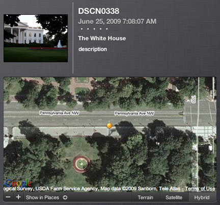
whitehousegps

Here is the the photo and the location identified by the geotag. At first the map information confused me – no white house. Then it I realized, we are standing on Pennsylvania Ave. on the other side of the fence shooting through the trees to frame the picture.

All images that appear here have been greatly reduced in size to fit within the form factor required for this blog.

Loading