When we write about potential projects for the classroom, we typically like to use local examples from teachers we know. It seems a good strategy to assure practicality. Sometimes we have something in mind and simply cannot find an example. When this is the case we like to experiment with the tools and techniques ourselves. We learn a lot and have a sense of the options that would be available for teachers.
So, we have been thinking about the GPS as a way to “fit information to location” (just made that phrase up but I like the way it sounds). Geocaching would be a possible example but we wanted something a little new. Cindy came up with the idea of mapping local historical sites. I was going to map houses for sale in the neighborhood. I liked her idea better.
A little Internet research revealed that a list of sites, addresses and GPS coordinates already existed. This made the activity pretty easy – I had hoped I could find a list of locations by address and we could then find the GPS coordinates to see if we could map buildings to Google street view. I guess you would not have to give out the coordinates.
We located buildings using the maps available on our cell phones and with a Garmin Nuvi 1300 I received as a Christmas present. This Garmin can be used in a vehicle or on foot. The plan was to locate a building, switch to “where am I mode”, write down the coordinates, take a picture of the building and then put everything together once back home.
We learned something quite interested about the Nuvi by accident – it is capable of screen captures (also storing personal photos just in case anyone could possibly think of a reason for showing family photos on his or her GPS).
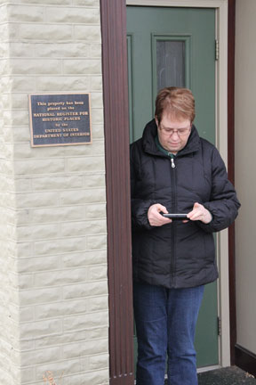
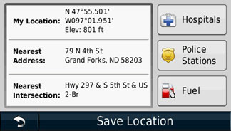
So, one of us would walk up to a building a record the coordinates by taking a screen shot.
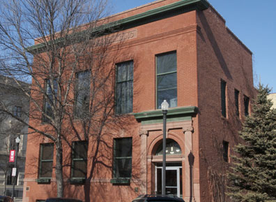
We would take a picture of the building.
We would store the coordinates using the Garmin Nuvi.
Now, you can use the coordinates above to see how well this works. Enter 47 55.501 – 097 01.951 in Google maps (see this GPA converter to understand a little more about GPS coordinates).
I had to spin the street view around –
But there was the same building I had recorded with my own camera.
BTW – the link to buildings on the list of historic places also provides access to information about the history of building. I would certainly have students read this content and also take additional photos to represent features of the buildings identified in these descriptions.
According to the documentation included with the request to declare this building a landmark:
Architecturally, this building is an outstanding example in original condition of the turn-of-the-century brick commercial style with classical detailing. Although architectural plans could not be located, the building was most likely designed by John W. Ross or Joseph Bell DeRemer, both of whom were practicing in Grand Forks at the time and actively designing commercial buildings in this style.
We did test this system in a way that involved a little more risk taking. We drove 40 miles into the country using GPS coordinates searching for a round barn (#17 on the list of Grand Forks County sites). But, that is another story.
Other images from our project are available from Picasa.
![]()


You must be logged in to post a comment.