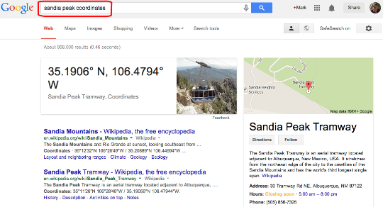
Here is another Google search feature that was new to me (credit to Daniel Russell for the tip). You can determine the latitude and longitude for a location of interest by search for locationname coordinates. I find the ability to geotag images of personal and educational benefit so this feature caught my attention. I have a very nice camera that takes great photos, but does not record coordinates. A cell phone will often collect such data and I commonly combine phone and camera photos for this reason.
Here is a demonstration for the location Sandia Peak (the search would be Sandia Peak coordinates).
The search results:
Here is a photo at the top of the peak captured with my phone (the exif data are provided). The data are difficult to read, but are very similar.
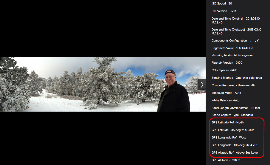
I see this is a post production tool useful in some situations for “mapping” digital camera photos.
![]()